
WAEC - Geography (2024 - No. 5)
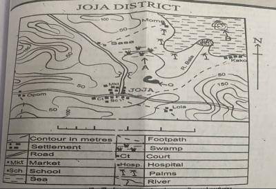
Study the map of Joja district and use it to answer this question
The highest point of the mapped area is approximately
325 meters
375 meters
390 meters
395 meters
Selitys
from the map, the highest point on the mapped area may be a bit above 250m